
Archivo: ArrTurnhoutLocatie
No disponible en mayor resolución.
ArrTurnhoutLocatie.png (270 × 203 píxeles; tamaño de archivo: 5 KB; tipo MIME: image/png)
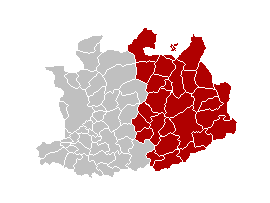
Description: This map indicates (in red) the location of administrative and judicial arrondissements of Turnhout in the province of Antwerp, Belgium. Both maps are the same and fill all the province of Antwerp. In this case, a redirection is avalaible at File:Judicial_Arrondissement_Turnhout_Belgium_Map.png for an easy and intuitive access to judicial arrondissement map.
Title: ArrTurnhoutLocatie
Credit: Own work
Author: w:nl:Gebruiker:Westermarck
Usage Terms: Creative Commons Attribution-Share Alike 3.0
License: CC-BY-SA-3.0
License Link: http://creativecommons.org/licenses/by-sa/3.0/
Attribution Required?: Yes
Usos del archivo
La siguiente página enlaza a este archivo:

Todo el contenido de los artículos de la Enciclopedia Kiddle (incluidas las imágenes) se puede utilizar libremente para fines personales y educativos bajo la licencia Atribución-CompartirIgual a menos que se indique lo contrario.