
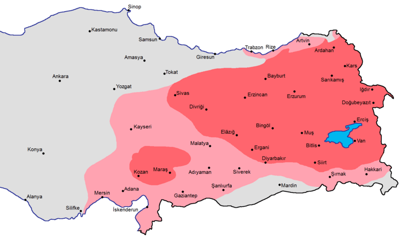
Archivo: Armenian presence within modern Turkish borders in early 1600s

Tamaño de esta previsualización: 800 × 481 píxeles. Otras resoluciones: 320 × 192 píxeles | 1636 × 984 píxeles.
Archivo original (1636 × 984 píxeles; tamaño de archivo: 82 KB; tipo MIME: image/png)
Description: A map showing the distribution of the Armenians in early 17th century with the current borders of Turkey: red (majority), pink (significant presence) source: State Committee of the Real Estate Cadastre of the Republic of Armenia (2007). Հայաստանի Ազգային Ատլաս (National Atlas of Armenia), Yerevan: Center of Geodesy and Cartography SNPO, p. 102 see map
Title: Armenian presence within modern Turkish borders in early 1600s
Credit: Own work
Author: Yerevanci
Usage Terms: Creative Commons Attribution-Share Alike 3.0
License: CC BY-SA 3.0
License Link: https://creativecommons.org/licenses/by-sa/3.0
Attribution Required?: Yes
Usos del archivo
La siguiente página enlaza a este archivo:

Todo el contenido de los artículos de la Enciclopedia Kiddle (incluidas las imágenes) se puede utilizar libremente para fines personales y educativos bajo la licencia Atribución-CompartirIgual a menos que se indique lo contrario.