
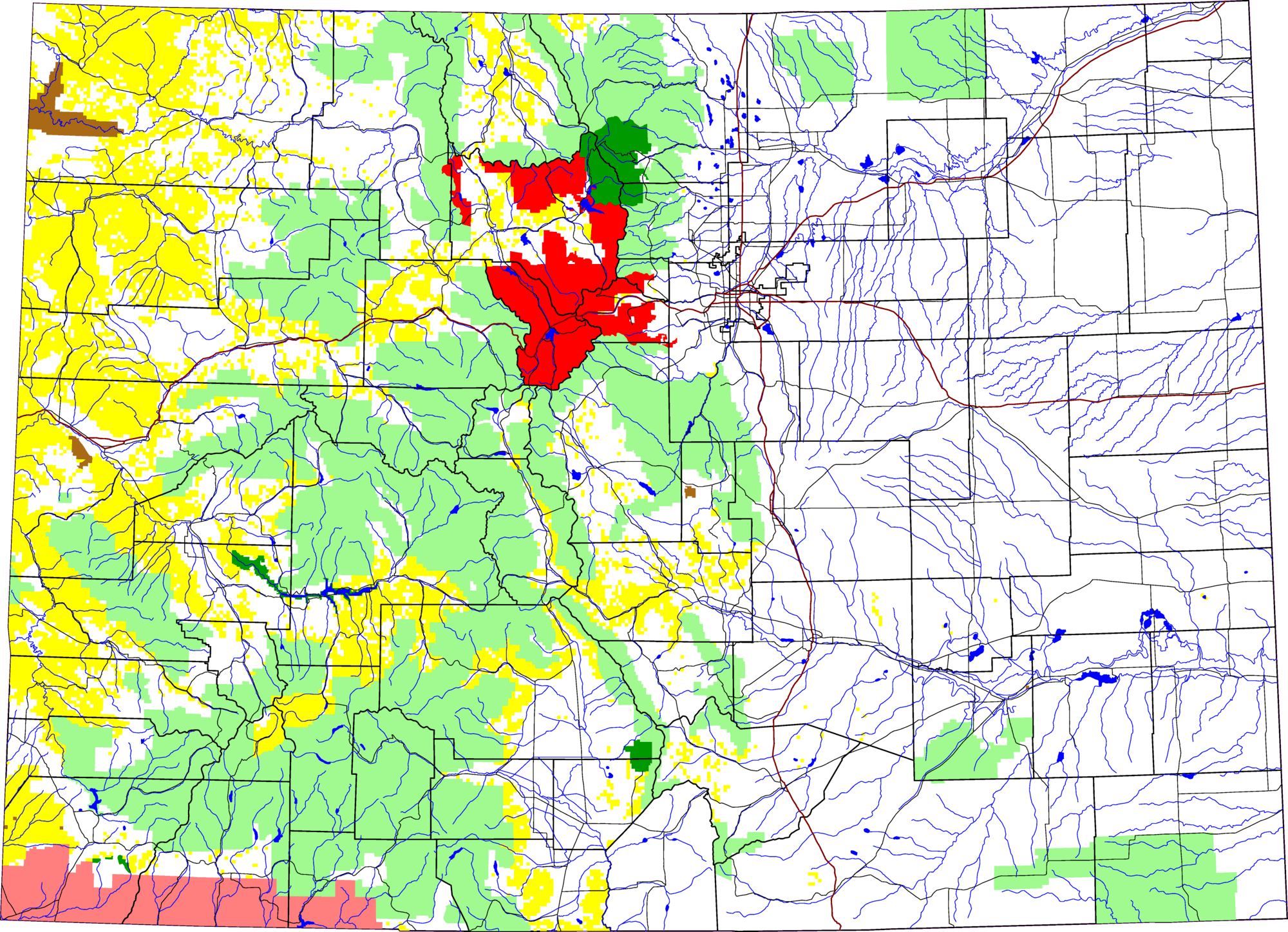
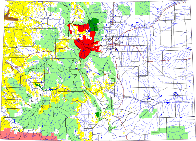
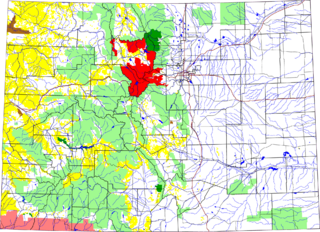
Archivo: Arapaho National Forest location in Colorado
Descripción: A map of Colorado, with Arapaho National Forest highlighted in red. The light green is other Forest Service land, yellow is BLM land, dark green is National Park, brown is National Monument or National Historic Site, pink is Indian reservation. The reddish lines are Interstate Highways. David Benbennick made this map with data from nationalatlas.gov. The map uses the azimuthal equidistant projection, centered on (-105.7167, 39.1333) (degrees latitude, longitude). The area outside Colorado is transparent, so it should look nice on non-white backgrounds. Eventually, I will upload the 4 megabyte Metapost script I used to make this map. In the mean time, see map.mp.
Título: Arapaho National Forest location in Colorado
Créditos: Trabajo propio
Autor(a): David Benbennick
Términos de Uso: Dominio Público
Licencia: Dominio Público
¿Se exige la atribución?: No
Usos del archivo
La siguiente página enlaza a este archivo:
