
Archivo: Apsley house on an 1869 Ordnance Survey Map
No disponible en mayor resolución.
Apsley_house_on_an_1869_Ordnance_Survey_Map.JPG (500 × 492 píxeles; tamaño de archivo: 79 KB; tipo MIME: image/jpeg)
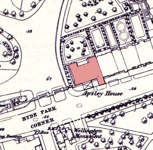
Description: Apsley House on an 1869 Ordnance Survey map, showing its position at the end of a terrace. The neighbouring houses were demolished in the post World War II period to allow Park Lane to be straightened and widened. The Wellington Monument has been moved since this time.
Title: Apsley house on an 1869 Ordnance Survey Map
Credit: Transferred from en.wikipedia to Commons by Oxyman using CommonsHelper.
Author: The original uploader was Oliver Chettle at English Wikipedia
Usage Terms: Public domain
License: Public domain
Attribution Required?: No
Usos del archivo
La siguiente página enlaza a este archivo:

Todo el contenido de los artículos de la Enciclopedia Kiddle (incluidas las imágenes) se puede utilizar libremente para fines personales y educativos bajo la licencia Atribución-CompartirIgual a menos que se indique lo contrario.