
Archivo: AncientEgyptJamesRennell01
Tamaño de esta previsualización: 541 × 599 píxeles. Otras resoluciones: 217 × 240 píxeles | 1548 × 1715 píxeles.
Archivo original (1548 × 1715 píxeles; tamaño de archivo: 384 KB; tipo MIME: image/jpeg)
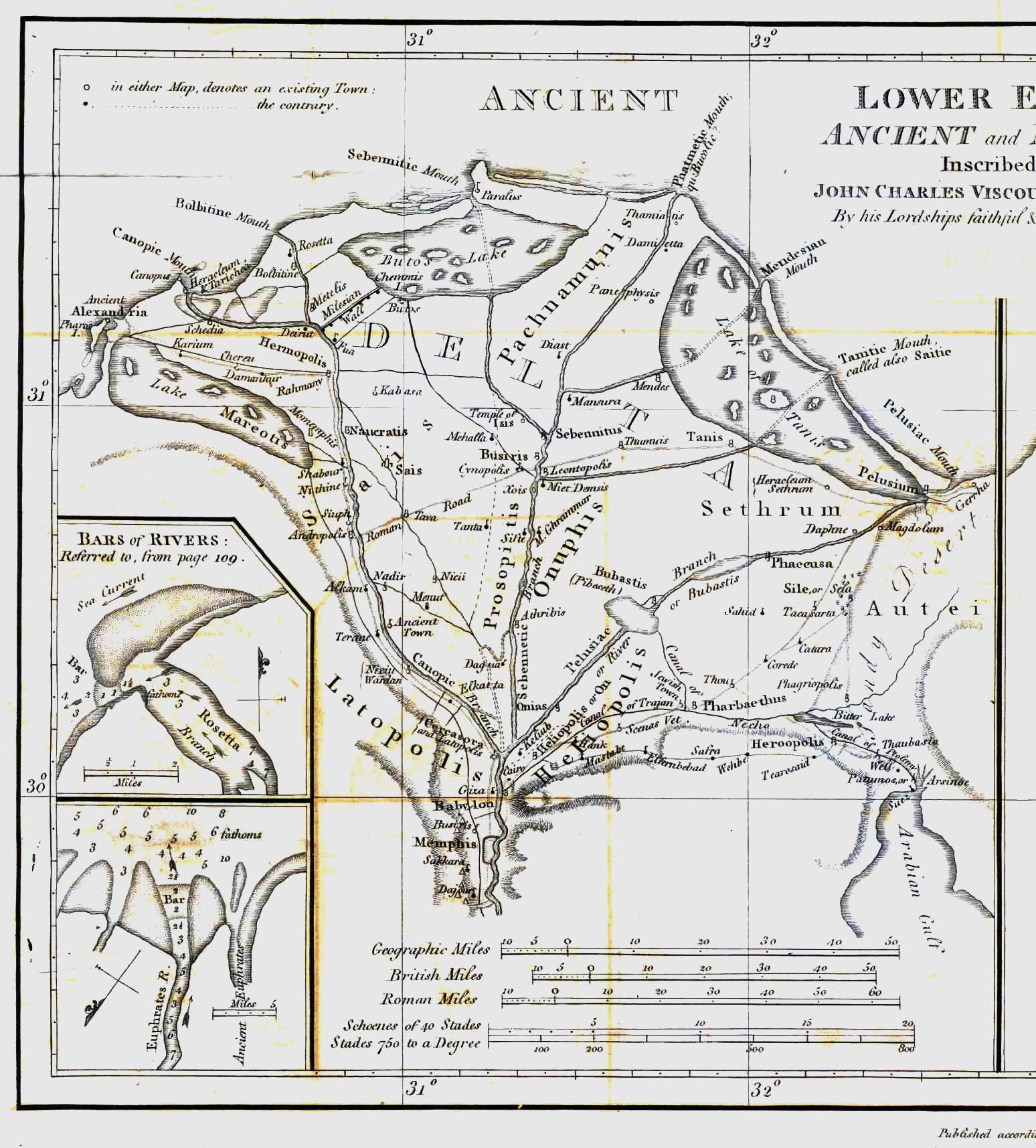
Description: Map of ancient Egypt created by James Rennell as an insert for his book "The geographical system of Herodotus examined and explained" (published 1800 and 1830). This map shows Rennell's understanding of the geography of Egypt's Nile delta during the Greek Classical period (510 BC - 323 BC) based on the writings of Herodotus (484 BC - 425 BC).
Title: AncientEgyptJamesRennell01
Credit: Book "The geographical system of Herodotus examined and explained", by James Rennell (published 1800 and 1830).
Author: Carl Drews scanned the map and enhanced the color contrast.
Usage Terms: Public domain
License: Public domain
Attribution Required?: No
Usos del archivo
La siguiente página enlaza a este archivo:

Todo el contenido de los artículos de la Enciclopedia Kiddle (incluidas las imágenes) se puede utilizar libremente para fines personales y educativos bajo la licencia Atribución-CompartirIgual a menos que se indique lo contrario.