
Archivo: Altay Mountains.500m

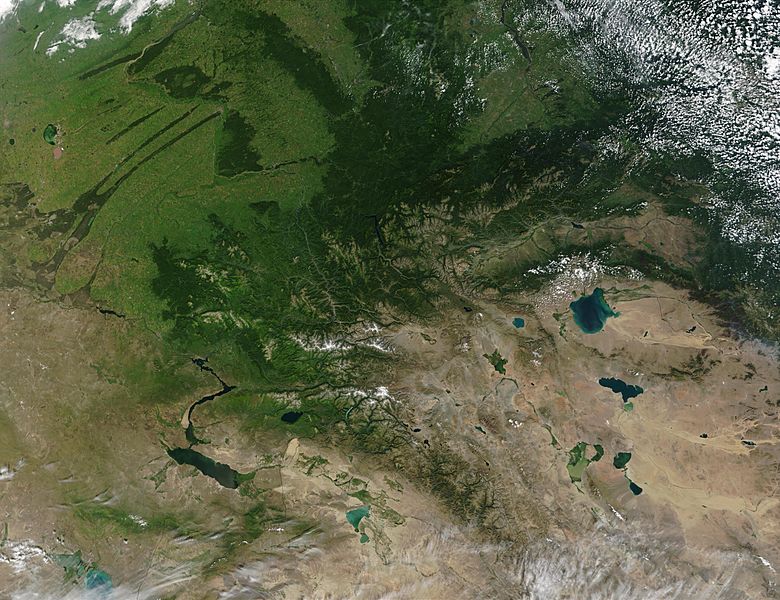
Descripción: In a picture from space territories of Russia, Kazakhstan, China and Mongolia. This true-color image from the Moderate Resolution Imaging Spectroradiometer (MODIS) on the Terra satellite of south-central Russia (top and left) shows the marked change in vegetation between Russia and northern Mongolia (bottom right) and northern China (bottom center). Southern Russia appears lush with forested mountain slopes and wetlands (dark green bands running southwest to northeast in the upper left corner of the image), especially compared to the more arid terrain of the countries to the south.
Título: Altay Mountains.500m
Créditos: http://visibleearth.nasa.gov/view.php?id=61439
Autor(a): NASA
Términos de Uso: Dominio Público
Licencia: Dominio Público
¿Se exige la atribución?: No
Usos del archivo
La siguiente página enlaza a este archivo:
