
Archivo: Alemannic-Dialects-Map-German
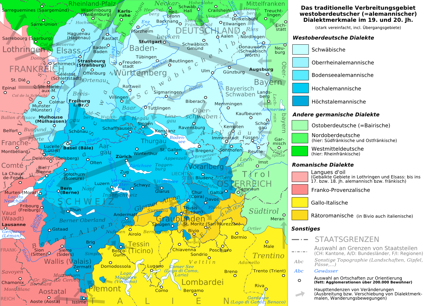
Descripción: THE PNG VERSION IS TO BE EMBEDDED IN THE ARTICLES, THE SVG-VERSION (SEE BELOW) CAN BE USED TO WORK WITH. The traditional distribution area of the western upper german (=alemannic) dialects in the 19th and 20th century. Source: Mainly these articles in the german wikipedia: * Alemannische Dialekte * Grenzorte des alemannischen Dialektraums * Traditionell rätoromanischsprachiges Gebiet Graubündens and * Sprachen und Dialekte in der Region Elsass, plus the (younger) literature, which is mentioned there. This area, having been quite stable for at least some 300 years up to the 19th century, saw consecutively more or less strong changes by industrialisation, population growth, migrations and political developments.
Título: Alemannic-Dialects-Map-German
Créditos: Alemannic-Dialects-Map-German.svg
Autor(a): Alemannic-Dialects-Map-German.svg: *Alemannic_language_location_map_in_1950-de.svg: derivative work: Pyrokrat (talk) Alemannic_language_location_map_in_1950-fr.svg: Sémhur derivative work: Testtube (talk)
Términos de Uso: Creative Commons Attribution-Share Alike 3.0
Licencia: CC BY-SA 3.0
Enlace de Licencia: https://creativecommons.org/licenses/by-sa/3.0
¿Se exige la atribución?: Sí
Usos del archivo
La siguiente página enlaza a este archivo:
