
Archivo: Aeolian Islands
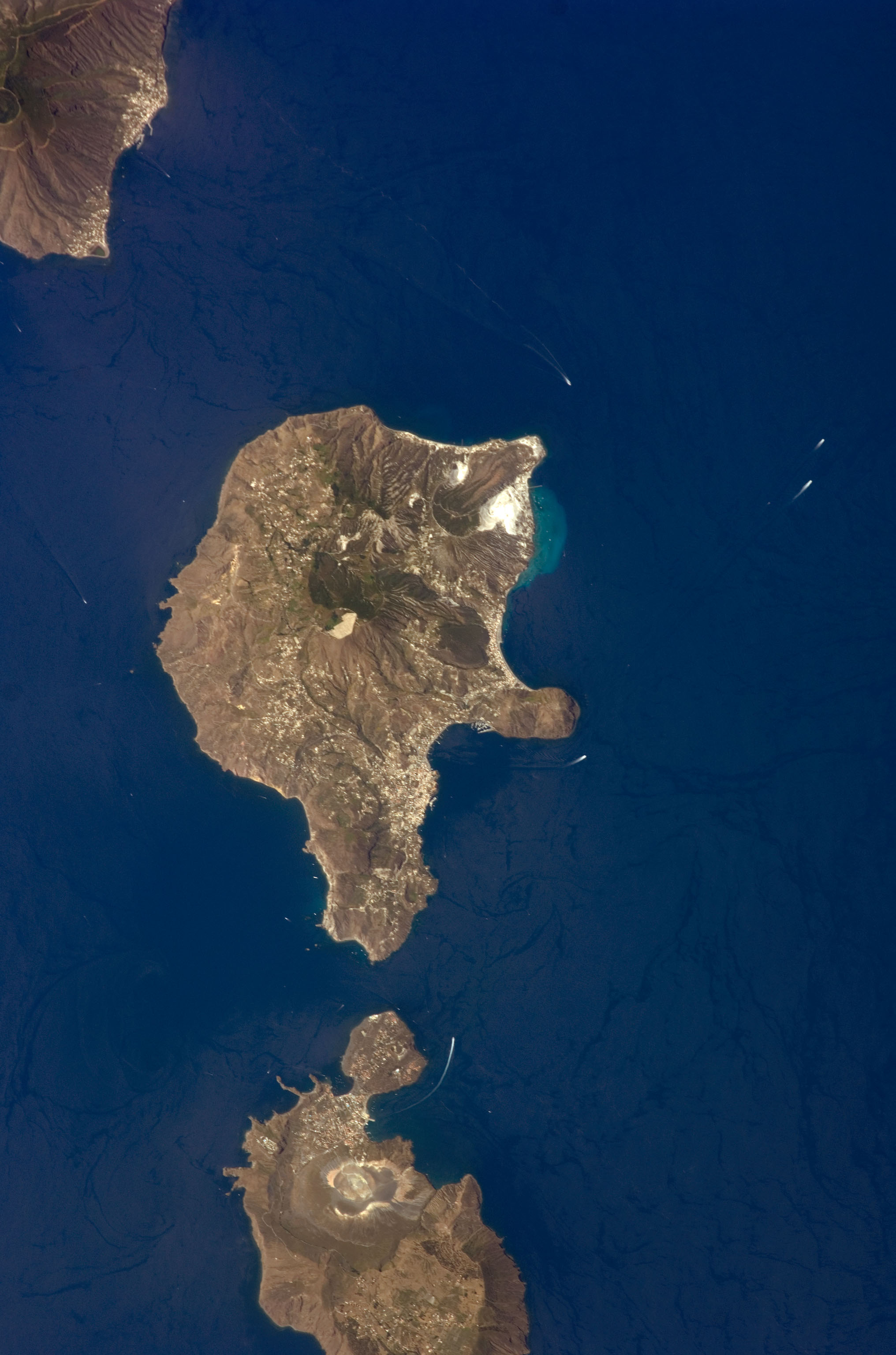
Description: This detailed astronaut photograph features Lipari Island and the northern portion of Vulcano Island. Tan, speckled areas on both islands are urban areas and towns. Lipari is the largest of the Aeolian Islands, and it is a popular tourist destination due to its rugged volcanic topography and beaches (several boat wakes are visible around the islands). White pumice beaches and caves are located along the northern and northeastern coastlines of Lipari; black sand beaches derived from lava flows can also be found on the island. The most recent eruptive activity on Lipari took place from approximately AD 580–729. ISS Crew Earth Observations: ISS017-E-9777 Identification Mission ISS017 (Expedition 17) Roll E Frame 9777 Country or Geographic Name SICILY Features LIPARI ISLAND, VULCANO ISLAND Center Point Latitude 38.5° N Center Point Longitude 14.9° E Camera Camera Tilt 17° Camera Focal Length 400 mm Camera Nikon D2Xs Film 4288 x 2848 pixel CMOS sensor, RGBG imager color filter. Quality Percentage of Cloud Cover 0-10% Nadir What is Nadir? Date 2008-06-24 Time 12:50:43 Nadir Point Latitude 37.7° N Nadir Point Longitude 15.4° E Nadir to Photo Center Direction Northwest Sun Azimuth 247° Spacecraft Altitude 187 nautical miles (346 km) Sun Elevation Angle 63° Orbit Number 2968
Title: Aeolian Islands
Credit: NASA Earth Observatory
Author: This image was taken by the NASA Expedition 17 crew.
Usage Terms: Public domain
License: Public domain
Attribution Required?: No
Usos del archivo
La siguiente página enlaza a este archivo:
