
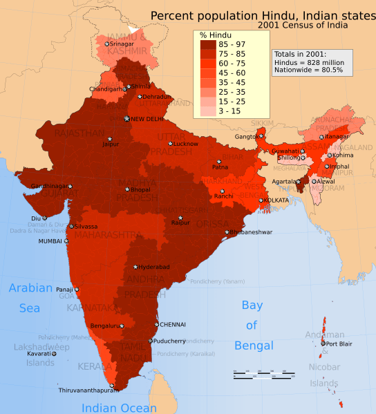
Archivo: 2001 Census India religion distribution map, percent Hindu in states and union territories

Descripción: The map shows the % of people in each state and union territory who declared themselves and their dependents to be a Hindu during the 2001 census of India. Source: Population by religious communities Census of India, Ministry of Home Affairs, Govt of India The Hindu distribution map varies within each district. The map shows state-wide average as reported by the Census. The table used to make this map does not provide further distribution of people by various schools of Hinduism. The disputed national borders SVG code used to create this map is a derivative work of File:India literacy rate map en.svg available on wikimedia commons.
Título: 2001 Census India religion distribution map, percent Hindu in states and union territories
Créditos: Trabajo propio
Autor(a): M Tracy Hunter
Términos de Uso: Creative Commons Attribution-Share Alike 3.0
Licencia: CC BY-SA 3.0
Enlace de Licencia: https://creativecommons.org/licenses/by-sa/3.0
¿Se exige la atribución?: Sí
Usos del archivo
La siguiente página enlaza a este archivo:
