
Archivo: 1947 Zhonghua Minguo Quantu
Tamaño de esta previsualización: 800 × 526 píxeles. Otras resoluciones: 320 × 210 píxeles | 3044 × 2000 píxeles.
Archivo original (3044 × 2000 píxeles; tamaño de archivo: 4,07 MB; tipo MIME: image/png)
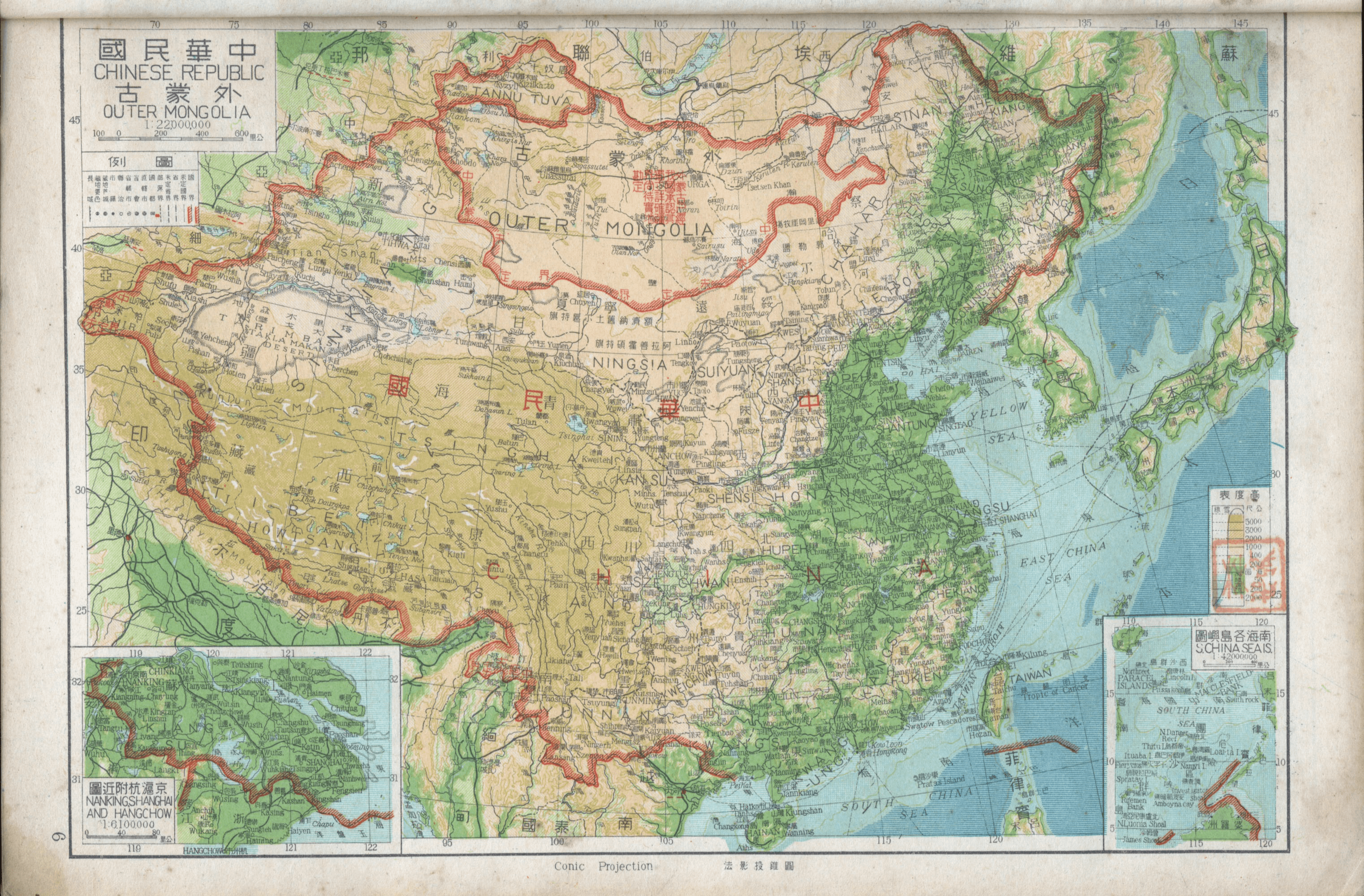
Descripción: Map of the Chinese Republic and Outer Mongolia published in 1947. The names of the South China Sea Islands (Nanhai Zhudao) in the map still used old names. At the top of the map in 1947, which indicates that Outer Mongolia has been recognized for independence by the government of the Republic of China, and show the border between China and Mongolia.
Título: 1947 Zhonghua Minguo Quantu
Créditos: https://www.nansha.org.cn/maps/3/1947_ROC_Map.jpg
Permiso: To uploader: Please provide where the image was first published and who created it or held its copyright.
Términos de Uso: Dominio Público
Licencia: Dominio Público
¿Se exige la atribución?: No
Usos del archivo
La siguiente página enlaza a este archivo:

Todo el contenido de los artículos de la Enciclopedia Kiddle (incluidas las imágenes) se puede utilizar libremente para fines personales y educativos bajo la licencia Atribución-CompartirIgual a menos que se indique lo contrario.