
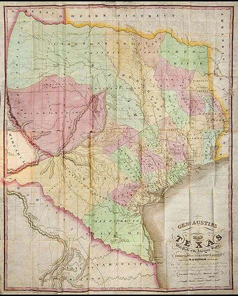
Archivo: 1840 Genl Austin's Map of Texas

Descripción: Large color folding map titled: Genl. Austin's Map of Texas with Parts of the Adjoining States, compiled by Stephen F. Austin. Published by H.S. Tanner, Philadelphia. Engraved by John & Wm. W. Warr, Philad. (29.5" x 23.5"). Included in the book "Map and Description of Texas, containing Sketches of its History, Geology, Geography and Statistics: With concise statements, relative to the soil, climate, productions, facilities of transportation, population of the country; and some brief remarks Upon the Character and Customs of its Inhabitants. By Francis Moore, Jr., Editor of the Telegraph and Texas Register." (Philadelphia: H. Tanner, Junr.; New York: Tanner & Distunell, 1840). First edition.
Título: 1840 Genl Austin's Map of Texas
Créditos: Dorothy Sloan Books
Autor(a): Stephen F. Austin. Published by H.S. Tanner, Philadelphia. Engraved by John & Wm. W. Warr, Philad.
Permiso: Esta imagen puede estar protegida fuera de los Estados Unidos —especialmente en Canadá, China (excepto Hong-Kong, Macao, o el área de Taiwán), Alemania o Suiza—. El creador y el año de publicación son información esencial y deben ser proporcionados. Véase Wikipedia:Derechos de autor para más detalles.
Términos de Uso: Dominio Público
Licencia: Dominio Público
¿Se exige la atribución?: No
Usos del archivo
La siguiente página enlaza a este archivo:
