
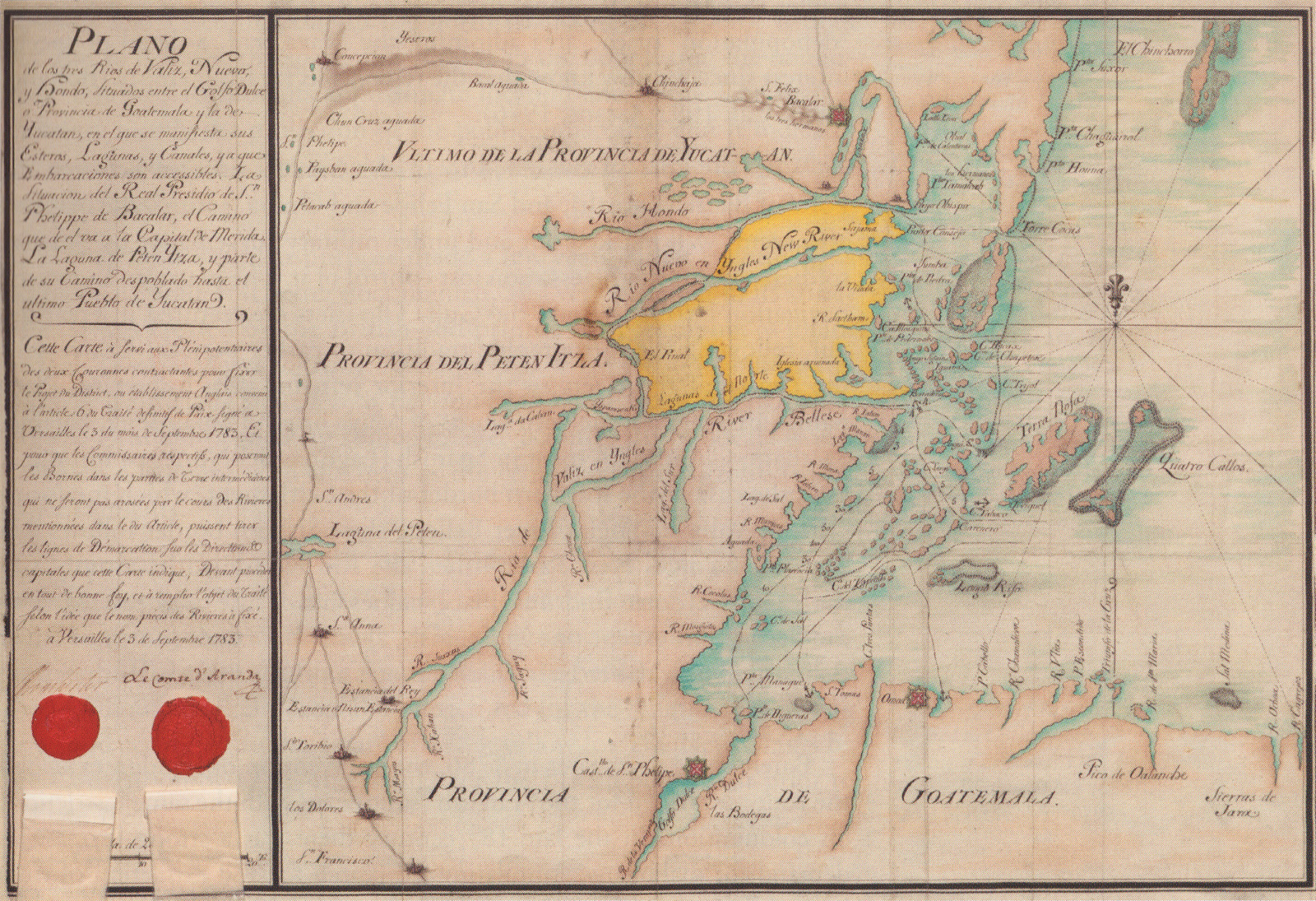
Archivo: 1783 map of British territory in the Yucatan
Descripción: Earliest known map of the territory allotted to English settlers in the Yucatan (shown in yellow) according to the treaty of 1783. Caption reads:Map of the three rivers, Valiz, Nuevo and Hondo, located between Golfo Dulce or Province of Goatemala and that of Yucatan, in which are noted the lagoons and canals accessible to boats. The location of Sn Phelippe de Bacalar's Royal Presidium, the trail to the Capital Merida. The lagoon of Peten Itza, and part of the depopulated trail to the last village in Yucatan. This map served for the Plenipotentiaries of both contracting Crowns to set out the District Project, or the English establishment agreed to in Article 6 of the Final Peace Treaty signed in Versailles on the 3rd of the month of September 1783. And so the respective Commissioners who will place Boundary stones in the intermediate pieces of Land, which will not be watered by the Rivers mentioned in this Article, can draw the Demarcation lines on the Directions and capitals indicated on the Map, it being required to proceed in all good faith, and fulfill the purpose of the Treaty according to the idea as set out by the exact name of the Rivers.
Título: 1783 map of British territory in the Yucatan
Créditos: Scanned from British Honduras: The invention of a colonial territory by Odile Hoffmann; Original source: The National Archives (United Kingdom)
Autor(a): DesconocidoUnknown author
Términos de Uso: Dominio Público
Licencia: Dominio Público
¿Se exige la atribución?: No
Usos del archivo
La siguiente página enlaza a este archivo:
