
Archivo: 1758 Bellin Map of Saint Lucia (Sainte Lucie), West Indies - Geographicus - SaintLucia-bellin-1758
Tamaño de esta previsualización: 800 × 522 píxeles. Otras resoluciones: 320 × 209 píxeles | 3000 × 1957 píxeles.
Archivo original (3000 × 1957 píxeles; tamaño de archivo: 1,61 MB; tipo MIME: image/jpeg)
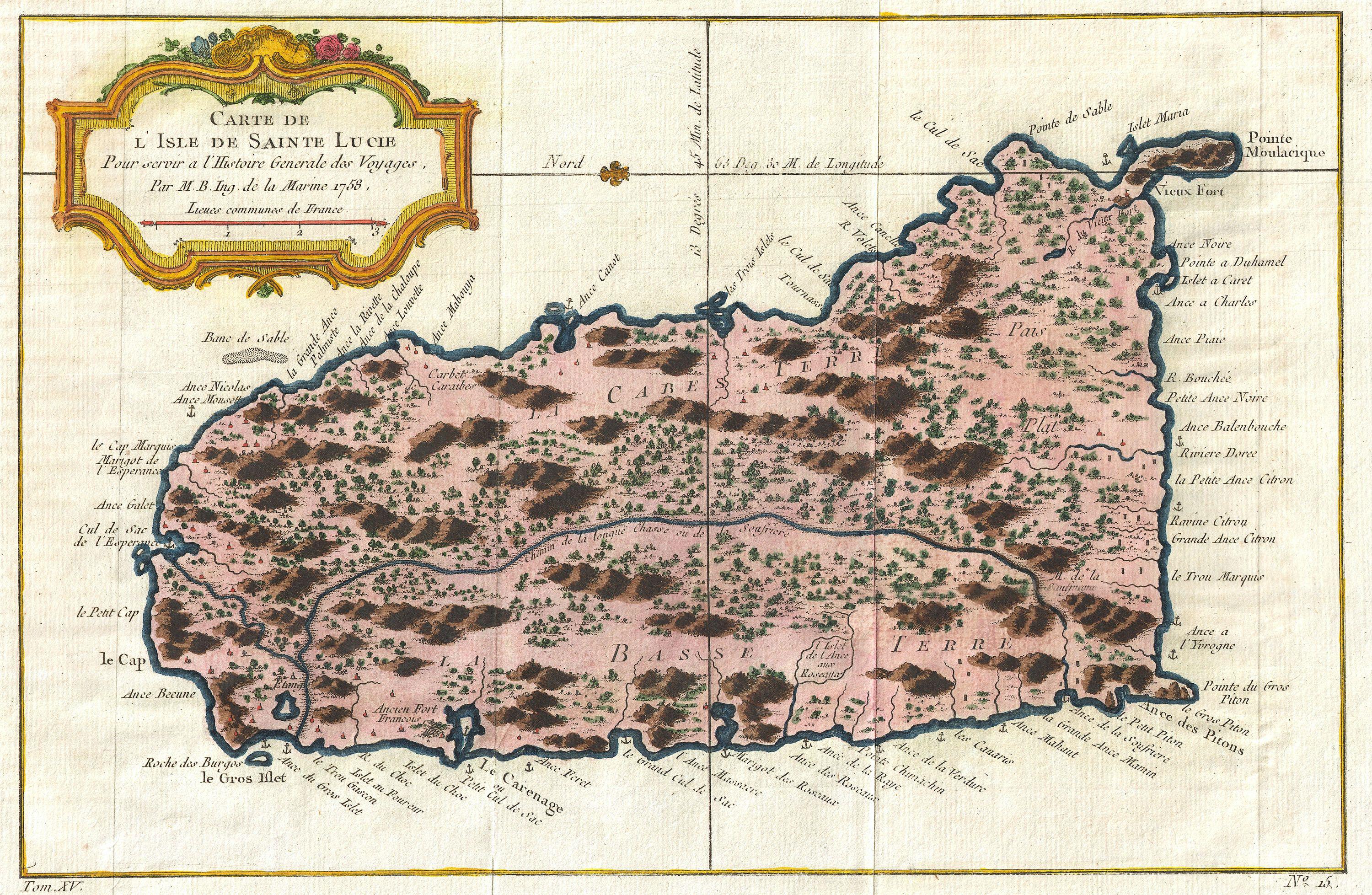
Descripción: An extremely attractive example of Bellin's rare 1758 map of Saint Lucia (St. Lucia) or Sainte Lucie in the West Indies. St. Lucia is considered to be one of the most beautiful of the Windward Isles. This map covers this spectacular Caribbean island in considerable detail showing mountains, cities, and forests in Bellin's distinctive profile style. Good harbors are marked with miniature anchors. A decorative rococo style title cartouche appears in the upper left quadrant. Drafted in 1758 by Jacques-Nicolas Bellin for publication in Provost's c. 1760 edition of L`Histoire Generale des Voyages .
Términos de Uso: Dominio Público
Usos del archivo
La siguiente página enlaza a este archivo:
,_West_Indies_-_Geographicus_-_SaintLucia-bellin-1758.jpg&oldid=2944755)

Todo el contenido de los artículos de la Enciclopedia Kiddle (incluidas las imágenes) se puede utilizar libremente para fines personales y educativos bajo la licencia Atribución-CompartirIgual a menos que se indique lo contrario.
,_West_Indies_-_Geographicus_-_SaintLucia-bellin-1758.jpg)