
Archivo: 16th century Portuguese Spanish trade routes
Tamaño de esta previsualización: 800 × 335 píxeles. Otras resoluciones: 320 × 134 píxeles | 2835 × 1188 píxeles.
Archivo original (2835 × 1188 píxeles; tamaño de archivo: 745 KB; tipo MIME: image/png)
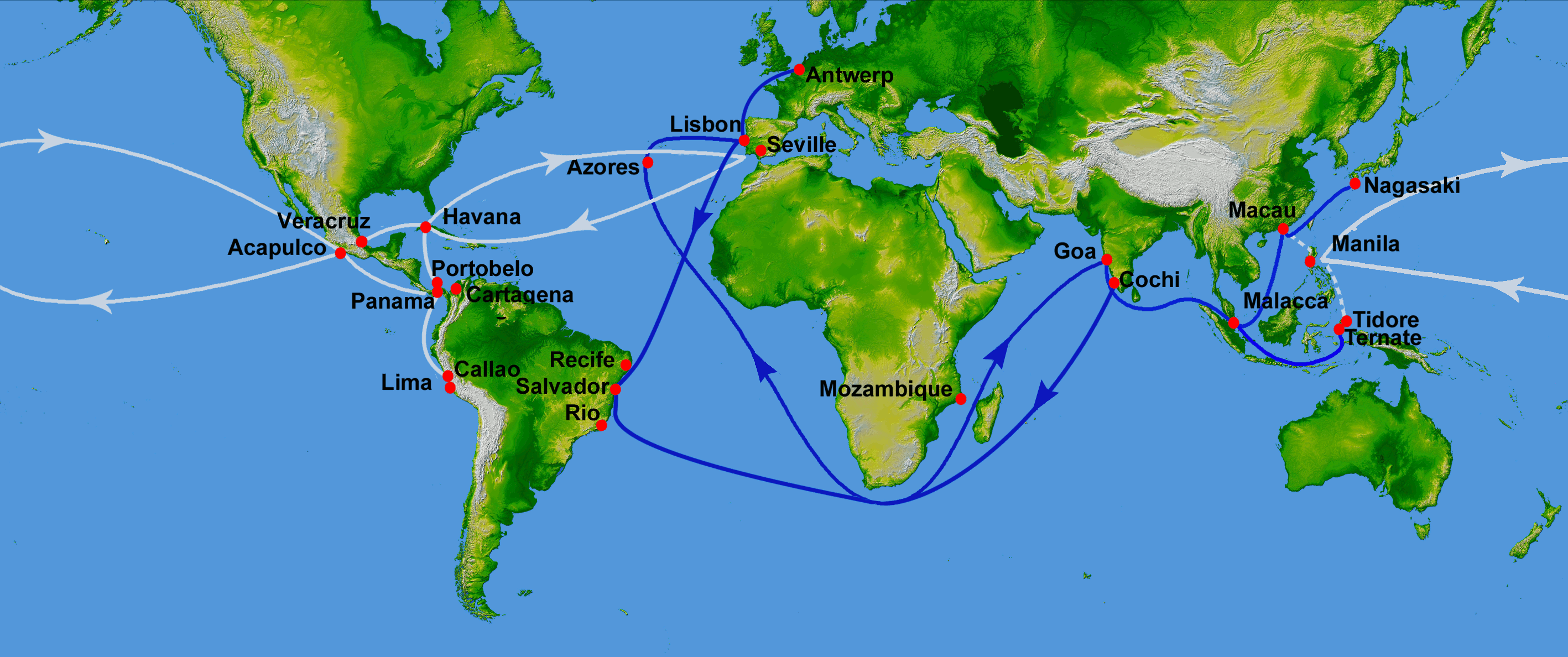
Description: Map showing main Portuguese (blue) and Spanish (white) oceanic trade routes in the 16th century, as a result of the exploration during the Age of Discovery. Showing the Spanish colonial Manila-Acapulco Galleons route (1565-1815) between the Viceroyalty of New Spain (México) and the Spanish East Indies (Philippines), using the ports of Acapulco and Cavite. PIA03395: World in Mercator Projection, Shaded Relief and Colored Height
Title: 16th century Portuguese Spanish trade routes
Credit: World_Topography.jpg
Author: World_Topography.jpg: NASA/JPL/NIMA derivative work: Uxbona (talk)
Usage Terms: Public domain
License: Public domain
Attribution Required?: No
Usos del archivo
Las siguientes páginas enlazan a este archivo:

Todo el contenido de los artículos de la Enciclopedia Kiddle (incluidas las imágenes) se puede utilizar libremente para fines personales y educativos bajo la licencia Atribución-CompartirIgual a menos que se indique lo contrario.